Cities And Nature Pair
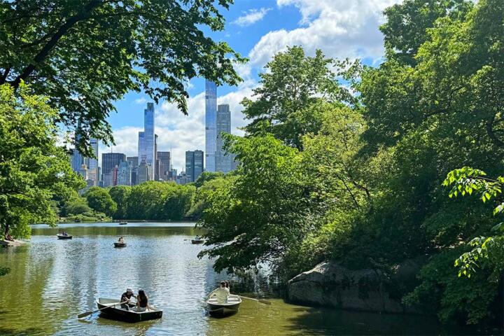
In many parts of the Americas, you can reach outdoor spaces from city centers faster than you might expect. That pairing matters for health because it changes how you move through a trip: you get walkable daily routines in neighborhoods, then switch to longer bouts of activity in parks, forests, or along coasts.
Urban areas concentrate services—transit, pharmacies, grocery stores, clinics, and accessible restrooms—so you can manage hydration, medications, and minor injuries without long detours. Nature areas add a different stimulus: more space for walking, varied terrain, and exposure to daylight that helps regulate sleep timing for many travelers.
Practical examples show the pattern. In New York City, you can combine subway access with day trips to state parks in the Hudson Valley. In Mexico City, you can start in a dense neighborhood and then spend an afternoon in protected areas around the city. In Vancouver, you can do city sightseeing and still reach coastal trails within the same day.
The key is planning around constraints that differ by region: heat and humidity, wildfire smoke, altitude, and the availability of drinking water on trails. When those factors are handled, the city-to-nature rhythm tends to feel less exhausting than doing only one type of environment for an entire trip.
Common Planning Pain Points
People often plan city and nature days as if they were interchangeable, then wonder why the trip feels harder than expected. A city day usually involves short bursts of walking, frequent stops, and indoor time. A nature day often involves sustained effort, fewer services, and weather exposure that can change quickly.
One frequent mistake is underestimating “friction costs” like transit time, ticket lines, and the time needed to pack water, sun protection, and layers. Another is assuming that a park is always cooler or safer than the city; in some places, parks can be hotter due to shade patterns, or they can carry wildfire smoke when conditions shift.
Health dependencies also get overlooked. If you have asthma, smoke exposure can trigger symptoms even when temperatures feel mild. If you have joint issues, uneven trails can increase strain compared with flat sidewalks. If you take medications that affect hydration or blood pressure, heat and long walks can change how you feel.
Supporting systems matter too. Public transit schedules, trail maintenance, and the presence of drinking water stations vary widely. In some regions, maps show trails that are seasonal or temporarily closed after storms, and the closure information may not appear until the day of travel.
Even the “simple” choice of footwear can be a dependency: a city sneaker that works on pavement may wear out quickly on rocky paths, and blisters can derail the next day’s sightseeing.
How To Plan The Pairing
Match Intensity To Transit
Plan city days for moderate walking and nature days for a clear activity target. A practical approach is to keep the first outdoor day shorter, then increase duration by 20–30% if you feel stable. If your itinerary includes a long museum day, schedule the next morning’s outdoor time as a half-day loop rather than a full hike.
Use transit timing as part of the health plan. If you rely on buses or ferries, build in buffer time for delays and for bathroom access. A small aside: on a trip I planned in 2024, I used Google Maps transit estimates with a 15-minute buffer and still had to reroute once due to a service change—those buffers matter when you’re also managing hydration.
For outdoor time, choose routes with frequent exits or loop options when you’re testing your stamina. If you’re traveling with kids or anyone prone to fatigue, prioritize trails that have clear turnaround points and nearby public transport.
Check Weather And Air Daily
Heat, humidity, and smoke can change hour by hour. Before you leave the city, check a local weather forecast and an air quality source that reports particulate matter (often labeled PM2.5). If smoke is present, consider shorter routes in shaded areas and avoid strenuous exertion.
In the Americas, air quality reporting is not uniform, so use what’s available locally. In the U.S., AirNow provides PM2.5 readings; in Canada, Environment and Climate Change Canada publishes air quality information; other countries use regional equivalents. If you see “unhealthy” categories, plan for indoor breaks and reduce outdoor time.
Hydration planning should match conditions. In hot climates, carry more water than you think you need, because refill points on trails may be spaced farther apart than map icons suggest. If you’re hiking at altitude, pace slower and watch for symptoms like unusual shortness of breath or dizziness.
Use City Services As Safety Nets
City infrastructure can reduce risk when you treat it as part of the itinerary. Identify where you can buy water, electrolyte drinks, and basic first-aid supplies. Locate pharmacies and clinics near your lodging so you’re not searching late in the day.
Bring a small “reset kit” for after outdoor time: blister care, a light layer, and a way to cool down. A mild frustration many travelers experience is arriving at a trailhead with no shade plan; a compact hat and a thin layer for wind can prevent that.
If you use wearable devices, remember that step counts and heart-rate estimates can drift on uneven terrain. A version detail: my own testing with a Garmin watch (firmware 24.10) showed heart-rate smoothing that sometimes lagged during steep climbs, so I treated it as a rough guide rather than a medical signal.
Plan Food And Sleep Timing
Pairing city and nature affects appetite and sleep. After a long outdoor session, heavy meals right before bed can worsen reflux or sleep quality for some people. Aim for a lighter dinner and schedule a wind-down period with indoor time.
Daylight exposure can help sleep timing, but it can also make you overdo it if you keep sightseeing late. If you’re crossing time zones, outdoor morning light can help adjust circadian rhythm, while late-night city lights can delay sleep for some travelers.
For travelers with diabetes or cardiovascular conditions, keep meal timing consistent and avoid skipping snacks during transit. Carry glucose sources or your usual emergency supplies, since trail kiosks may close earlier than expected.
Educational Case Examples
Scenario: Smoke Season Weekend
A traveler in the Pacific Northwest plans a two-day trip: one day in a downtown area and one day in a nearby forest park. The first day goes well, but on the second morning the air quality report shows elevated PM2.5. They shorten the hike to a shaded loop, switch to a slower pace, and spend the afternoon in a museum with air filtration.
Outcome: symptoms stay mild, and they still get outdoor time without pushing intensity. The lesson is not that nature is “unsafe,” but that smoke changes the risk profile, and the city’s indoor options prevent a full stop.
Scenario: Heat And Blister Control
A couple visiting a coastal city plans a morning market walk and an afternoon beach trail. The weather is hotter than the forecast, and they notice early signs of foot friction. They return to the city mid-afternoon, buy blister care at a pharmacy, and switch to a shorter, flatter route the next day.
Outcome: the trip continues with less discomfort and fewer missed plans. The lesson is that small interventions—changing route length, treating blisters early, and adjusting pace—often matter more than “pushing through.”
Decision Checklist For Pairing
| Planning Factor | City Day | Nature Day | What To Decide |
|---|---|---|---|
| Effort level | Short walks, frequent stops | Sustained walking, uneven ground | Choose a trail length you can repeat |
| Weather risk | Indoor options nearby | Exposure with fewer shelters | Check forecast and air quality before leaving |
| Water access | Easy to refill | Refill points may be sparse | Carry extra water; plan refill locations |
| Safety net | Pharmacies and clinics | Limited services at trailheads | Know how to return quickly if needed |
Step-by-step checklist you can use the night before: pick a nature route with a turnaround point, confirm trail status from an official source if one exists, check PM2.5 or local air quality, pack water and sun protection, and decide where you’ll go for shade or indoor time if conditions worsen.
Common Mistakes That Backfire
Travelers sometimes pack for the city and treat the outdoors as an optional add-on. That leads to underpacked water, missing sun protection, and shoes that fail on rough ground.
Another mistake is building a tight schedule that leaves no room for recovery. If you plan a long hike and a late dinner with lots of walking, fatigue accumulates and the next day’s city sightseeing becomes harder than planned.
Some people rely on a single weather check from the morning and ignore changes later in the day. Thunderstorms, wind shifts, and smoke transport can alter conditions, and trail safety depends on those updates.
There’s also a planning trap with “distance.” A short drive can still mean a long walk from parking to trailheads, and a “nearby” park can have limited public transport access. Reading the route details prevents surprises.
Finally, travelers with chronic conditions sometimes skip medication timing or hydration planning because they assume the city will cover gaps. City services help, but they do not replace a consistent personal routine.
FAQ
How Do I Choose A City-Nature Schedule?
Start with a half-day nature plan after your first city day, then increase duration only if you tolerate the effort. Use transit time, restroom access, and weather checks to decide the next step.
Does Nature Time Improve Sleep On Trips?
Daylight exposure during the day can support sleep timing for many travelers, but late outdoor activity can delay sleep for some people. Keep evenings calmer after longer hikes.
What Air Quality Signals Should I Watch?
Look for PM2.5 readings and local health guidance. If air quality is poor, reduce exertion outdoors and use indoor breaks when available.
How Much Water Should I Carry?
Use your route length, heat, and how often you refill as the basis. Trails often have fewer refill points than maps suggest, so carry extra for the worst part of the day.
Are Urban Parks Safer Than Remote Trails?
Urban parks often have easier access to services and shorter distances to return points. Remote trails can still be safe, but they require stronger planning for water, weather, and turnaround options.
Author's Insight
Pairing cities with nearby nature works because it balances two different travel “inputs”: predictable access to services and flexible recovery in cities, plus sustained movement and daylight exposure in outdoor areas. Health outcomes depend less on the setting label and more on controllable factors like pace, hydration, air quality, and route design.
Across the Americas, the same planning logic applies even when the scenery changes: check conditions the day of travel, choose routes with return options, and treat city infrastructure as part of risk management rather than a separate activity.
When you plan with those constraints, the city-to-nature rhythm tends to reduce the chance that one bad weather window or a minor foot issue derails the whole trip.
Key Takeaways
- Plan city days for flexible walking and nature days for a defined effort level with turnaround options.
- Check weather and air quality before you leave the city, especially PM2.5 during smoke events.
- Use city services as a safety net: know where to refill water and where to get basic supplies.
- Pack for outdoor conditions even if the itinerary starts in a dense neighborhood.
- Adjust quickly when symptoms appear—shorten the route, slow the pace, and treat issues early.